WeTOD: Aviation Redefined by Haritaevi
Explore 3D visualizations of obstacles and surfaces with WeTOD, your trusted platform for aviation excellence.
Industry Standards Compliance
Adheres to the highest industry standards.


Discover The Key Features
Of WeTOD
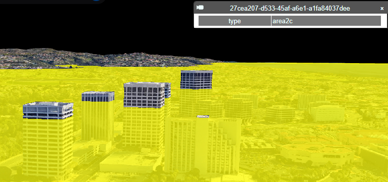
3D Map
Experience an interactive 3D map that brings terrain shapes, building heights, and geographical features to life with elevation and depth visualization.
Observing Obstacles Surfaces on the Map
Visualize critical obstacles directly on the map and analyze potential terrain challenges to enhance operational safety.
KML File Upload Visualization & Comments Section
Easily upload KML files to display customized geographical data on the map, and collaborate with others by leaving comments on specific areas for feedback.
Interactive Global Airport
Visualization
Choose The Perfect Plan For You
Basic
- Access obstacle and surface visualizations with basic functionality.
Professional
- Visualize obstacles and surfaces with enhanced tools and export data in .shp format.
Enterprise
- Leverage full access to advanced tools, including data export (.shp files) and KML uploads for in-depth analysis.
Frequently Asked Questions
We Receive
What Key Features Does WeTOD Provide?
WeTOD offers obstacle visualization, 3D terrain mapping, advanced data export...
Which Cutting-Edge Technologies Power WeTOD?
Our platform leverages cutting-edge technologies such as Cesium ION, advanced...

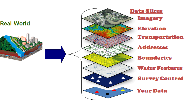
How Does WeTOD Source Its Data?
WeTOD aggregates data from international aviation authorities, open data portals,...

What Advanced Filtering Capabilities Are Available?
Users can filter data by geographic location, obstacle type, altitude,...